


Text by Dr. Ammad Waheed Qazi & Dr. Asifa Iqbal
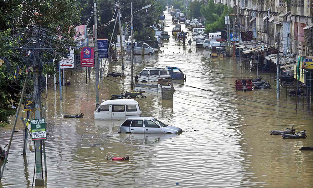
Each year, as the monsoon clouds gather over Karachi, so does a sense of dread. Streets turn into streams, underpasses become swimming pools, as a result, many people are found trapped or in dangerous situations, highlighting the severe impact of the rain on the city’s residents. Urban flooding has become a routine crisis for this megacity of over 20 million. But what if Karachi didn’t have to fight water with more concrete? What if the city could absorb the rain, like a sponge?
This is the vision behind the Sponge City Model, a nature-based approach to urban planning that our research team explored in a recently published study “Utilizing Remote Sensing for Sponge City Development: Enhancing Flood Management and Urban Resilience in Karachi” led by Dr Asia Iqbal, with coauthors including myself, this work uses satellite data and smart mapping techniques to offer solutions rooted in green infrastructure.
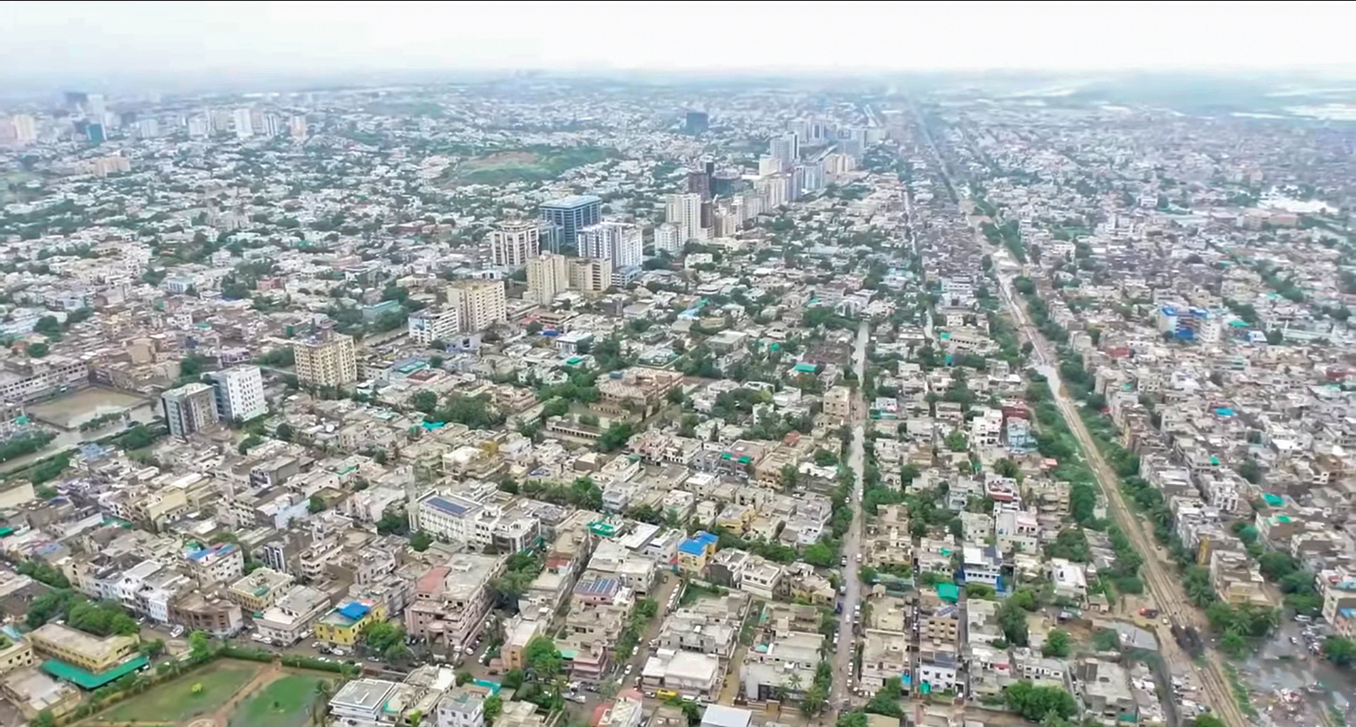
Over the past few decades, Karachi’s rapid and largely unregulated urban expansion has paved over its natural landscape. What was once sandy soil and scattered vegetation is now a blanket of concrete, tiles, and asphalt. This ‘hardscape’ prevents rainwater from seeping into the ground. Instead, it rushes over surfaces, collecting in low-lying areas, overwhelming drainage systems, and flooding entire neighborhoods. Our study reveals that areas like DHA, Korangi, and Gulshan-e-Jauhar are especially vulnerable due to low elevation and dense construction,” (for further details, see Iqbal et al., 2025). These conditions make Karachi not only vulnerable to frequent inundation but also increasingly unlivable during monsoon months.
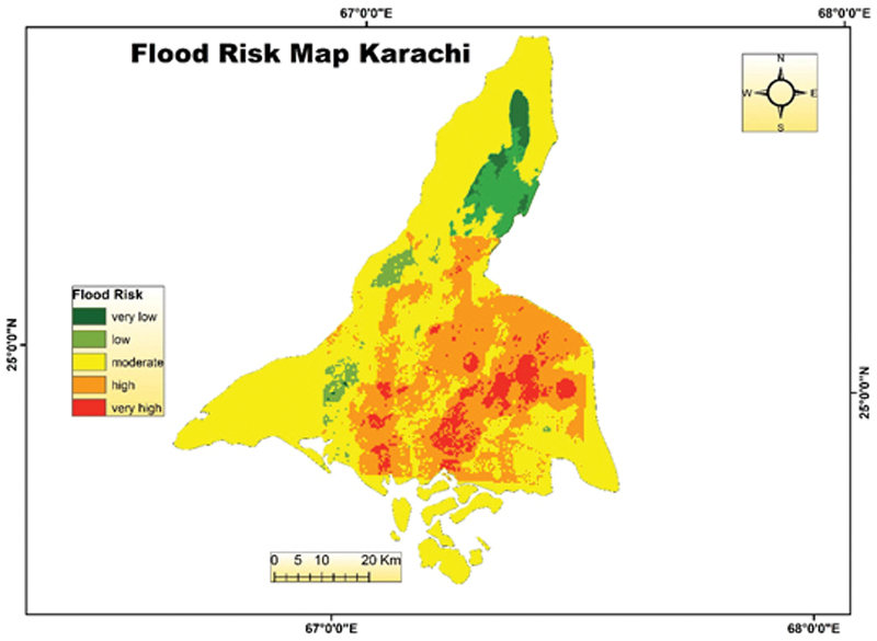
To better understand and predict flood risks, we turned to Remote Sensing (RS) and Geographic Information System (GIS) technologies that allow for real-time and long-term monitoring of the Earth’s surface using satellite data that allows scientists to observe and map land features using satellite imagery and data layers. We examined eight key flood-conditioning factors: rainfall trends, elevation, drainage density, aspect, land use, and proximity to rivers and roads. Using the Analytical Hierarchy Process (AHP), a tool for multi-criteria decision making, we created flood risk maps that show which areas are most at risk and why. These maps are more than academic exercises. They offer actionable insights for urban planners, policymakers, and disaster response agencies.
The Sponge City concept fundamentally redefines our approach to rainwater, viewing it not as a mere waste product to be drained away but as a valuable resource that can be skillfully managed. This innovative model encourages cities to incorporate green infrastructure that absorbs, filters, and reuses rainwater.
Examples include:
– Green roofs that soak up rainfall.
– Permeable pavements that let water pass through.
– Rain gardens that slow and clean stormwater.
– Urban wetlands that store excess runoff naturally.
These interventions help reduce flooding, cool urban areas, recharge groundwater, and enhance biodiversity.
Karachi’s’ climate and topography already present flood risks, but climate change is making the situation worse. Between 2016 and 2024, average annual rainfall in some parts of the city exceeded 550 mm. Combined with continued land development and minimal green cover, the city’s ability to handle water has become severely compromised. Satellite imagery analysis from 1990 to 2024 shows that barren land has shrunk by over 76% and built-up areas have expanded dramatically. This means less space for water to seep in and more surface runoff during storms (for more details, see Iqbal et al., 2025).
The Sponge City framework offers Karachi a practical and affordable way forward. It doesn’t require demolishing existing structures in the city, instead, it encourages retrofits and small-scale interventions in high-risk areas. Spong City principles are already being applied worldwide. Chinese cities like Wuhan and Shenzhen have adopted it successfully. European cities such as Rotterdam and Hamburg use green infrastructure to handle stormwater while enhancing public space.
For Karachi, the stakes are higher. Our research emphasizes the need to localize sponge city planning, account for space constraints, informal settlements, and inequalities in infrastructure access. Green roofs or bioswales alone won’t solve the flooding crisis. But targeted, data-informed interventions, supported by local communities, could make a real difference.
From our research, we recommend the following steps:
– Use flood risk maps to prioritize green infrastructure in zones like Korangi and DHA.
– Revise building codes to encourage permeable materials in sidewalks and parking lots.
– Incentivize and restore natural drainage channels, especially near the Gujjar and Orange Nullahs.
– Engage communities in co-designing rain gardens and vegetated parks.
Transforming Karachi into a Sponge City won’t happen overnight. But even small steps, more green spaces, better drainage design, and smarter land use can reduce the severity of flooding and improve the city’s resilience to climate change.
As coauthors of this study, we believe the real challenge is not technological but institutional and social. We must bridge the gap between research and policy, and between policymakers and communities. Sustainable urban development can’t happen without inclusive planning and public interest.
Karachi doesn’t have to remain trapped in a cycle of disaster and repair. By embracing the Sponge City approach, we can create a future where rain is not having threat but a resource, a chance to redesign our urban spaces for resilience, health, and beauty.
Let us start up the storm, one green rooftop, one raingarden, one neighborhood at a time.
Dr. Ammad Waheed Qazi
Department of Environmental Science, International Islamic University Islamabad
Dr.Asifa Iqbal
Department of Computer and Geospatial Sciences, University of Gävle, 801 76 Gävle, Sweden


